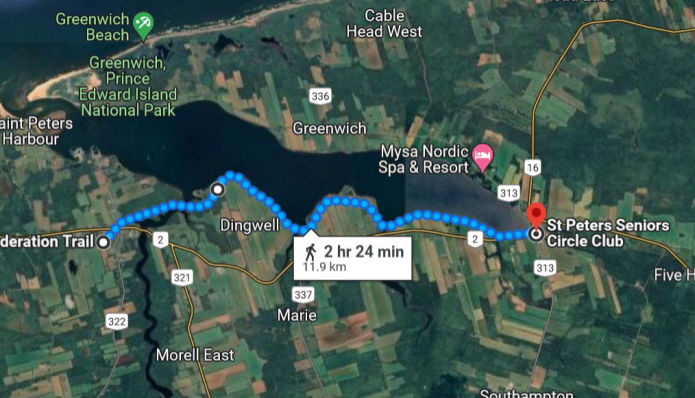
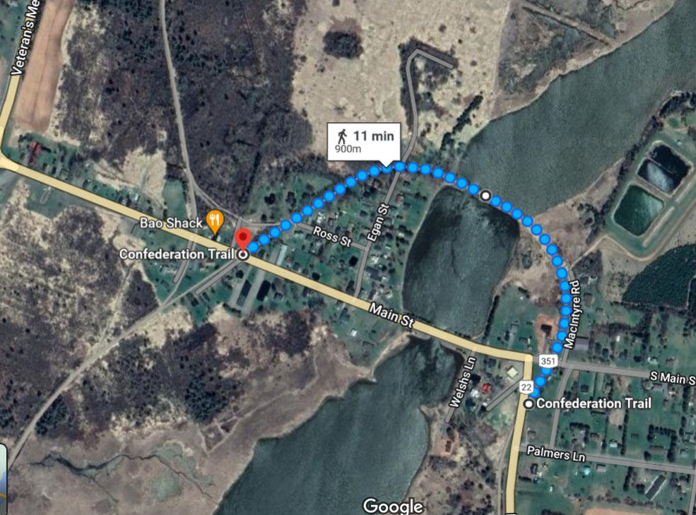
Morell-St Peter's
Factors affecting choices for exclusion zone borders:
- Residential or urban areas where manure at the side of the trail is likely to be less well-tolerated than in rural areas
- Parks/manicured waterway landscapes within village settings at dead ends of the trail i.e. no Point A to Point B travel-through value
- Areas with predictably high numbers of other users, especially where combined with other challenges e.g. multiple bridges
- Areas with high density of high-traffic road crossings and low rural scenic value
The horse-friendly segment's trailhead would be in Elmira, at the train station, which has a big parking lot. The end point for the segment would be Hwy 2.
Maps: Exclusion starting from Hwy 2 at St Peter's to Coffin Rd, just west of Morell.
Morell-St Peter's
The equestrian-friendly start point would be Station Lane in Murray Harbour. The end point would be the Visitor Information Centre in Wood Islands, which has a big parking lot.
Map: Exclusion zone is a small park in Murray Harbour, which is at the end (or start, depending on POV) of the trail.
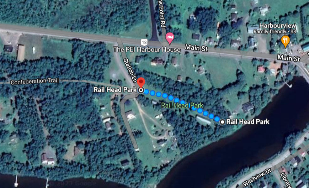
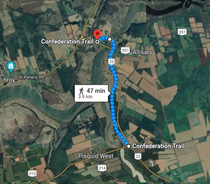
Murray Harbour
No exclusion zones.
Equestrian-friendly segment would start somewhere near Pisquid/Mt Stewart, and end at Georgetown.
No exclusion currently envisioned for Cardigan, which is part of this segment.
Georgetown exclusion begins at Poppy Rd, to the end of the trail.
Montague exlcusion is from Shaws Lane, to the end of the trail.
Mt Stewart may not need to be excluded. Current considerations: exclude from Hwy 21 to Main St (larger exclusion zone), OR Hwy 22 to Main St (smaller exclusion zone).
Maps: Georgetown, Montague, and options for Mt Stewart.
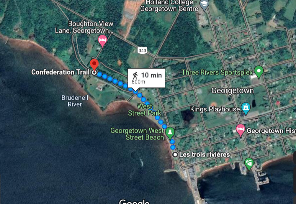
Georgetown
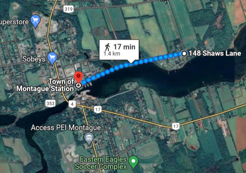
Montague
Mt Stewart (smaller exclusion zone)
Pisquid to Mt Stewart (larger exclusion zone)
This segment starts at the trail junction near Lake Verde, and extends towards Charlottetown to end at Mt Herbert.
No exclusion zones.
The equestrian zone starts at Coffin Rd near Morell, and extends to Winsloe Rd north of Charlottetown.
The esclusion zone is from Winsloe Road to Firefighter's Association on Miles Boulter Drive, and from the trail junction at the north end of the city to the trail end in town.
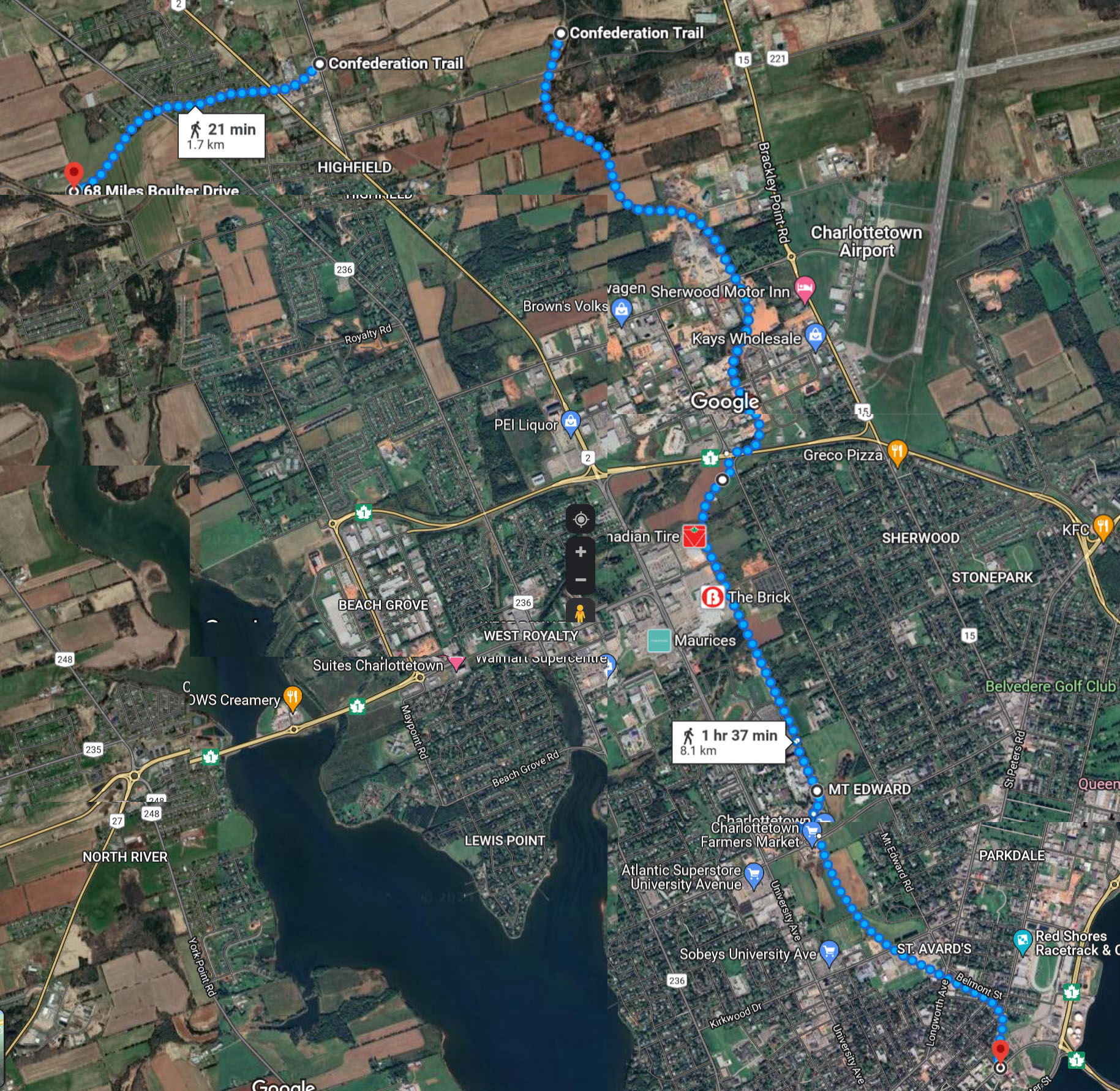
Charlottetown
The start point for the segment is the Firefighter's Association on Miles Boulter Drive, and the end point needs to be chosen in the Hunter River area.
Possible exclusion zones could be from Clyde Rd to Darlington Rd (larger exclusion zone), or points on the trail that are closer to Hunter River and are not actual road intersections (smaller exclusion zone)
Maps: exclusion zones either from road intersections (larger exclusion zones) or from GPS points (smaller exclusion zones)
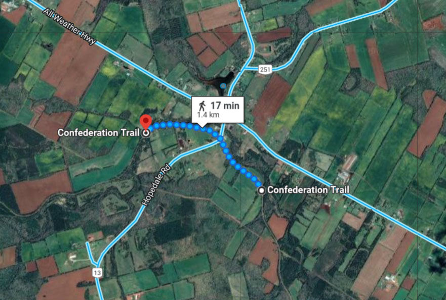
Hunter River (smaller exclusion zone)

Hunter River (larger exclusion zone)
Segment is from whatever starting point is chosen in Hunter River, to an end point in Kensington.
Exclusion could begin at Hwy 2, or Victoria St, or a point in between (Kensington Agri Services, Kensington Veterinary Clinic, or Kensington Country Store). End of Exclusion would be Cavendish Agri Services.
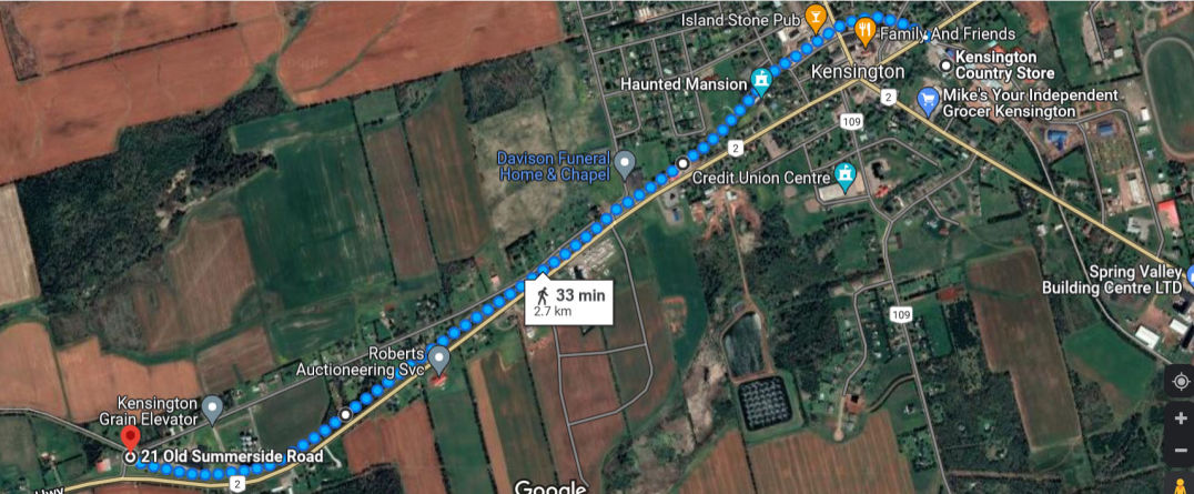
Kensington (smaller exclusion zone)
Kensington (larger exclusion zone)
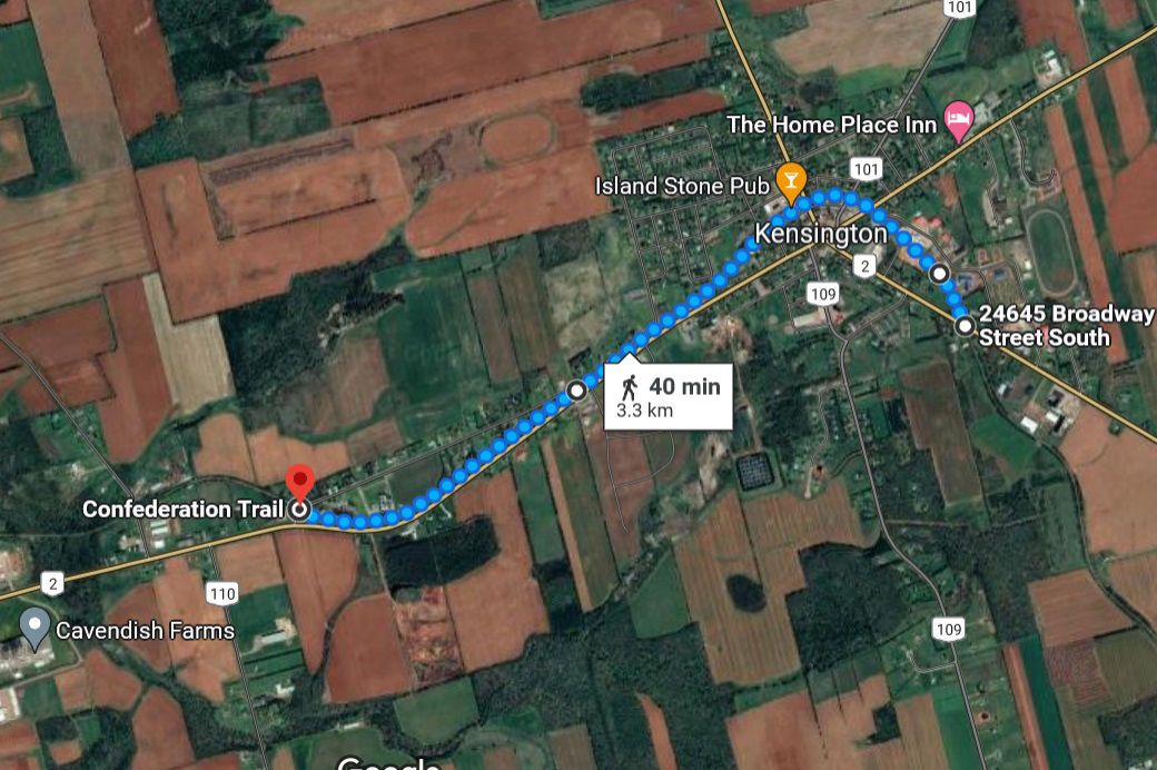
Starting point for the segment is the trail junction with Old Summerside Rd, and the end point is Read Drive.
Exclusion zone begins at Read Dr and ends at the trail junction near Glenn Dr in Linkletter.
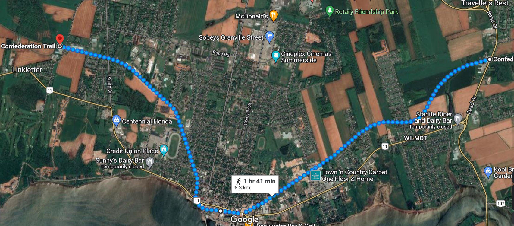
Summerside
Segment Starts at Glen Dr west of Summerside. Nearby junction includes a spur north which has no exclusions. Segment ends at Ascension Rd in Tignish.
O'Leary may not need to be excluded. If it is, proposed exclusion zone would start at access point on Buchanan Rd and end at the current approved parking area at the track.
Tignish exclusion starts at Ascension Rd, to the end of the trail.
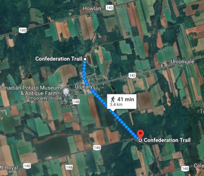
O'Leary
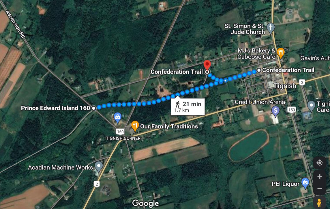
Tignish
Mobirise website creator - More